[ who we are ]
Precision Data for Builders Who Can’t Afford to Guess
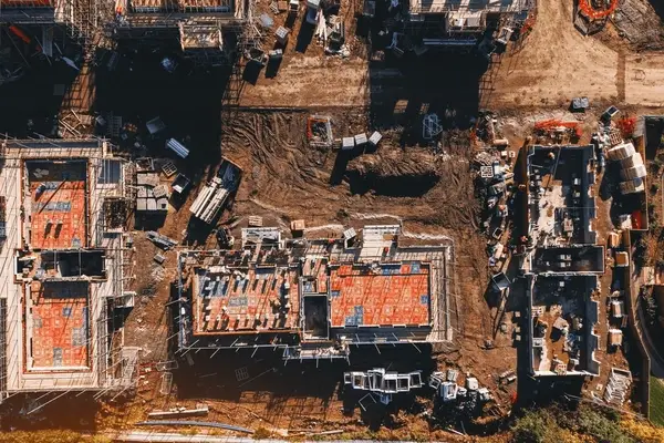
At Blue Nose Aerial Imaging of the Treasure Valley we provide more than visuals.We deliver aerial intelligence that lets Idaho’s top contractors, agencies, and utilities monitor progress, verify work and resolve disputes without stepping on site.
The Treasure Valley is one of the fastest-growing regions in the country. Ada and Canyon counties have added nearly 100,000 residents since 2020, pushing the combined population past 822,000
boisedev.com
. Mega-projects like the $15 billion Micron expansion, the Meta data center in Kuna, and the SH-16 corridor extension are reshaping the valley’s landscape while straining an already-tight labor market
idahobusinessreview.com
.
Teams working these sites face tight schedules, slim margins and rising documentation demands. Too many UAV providers just send pretty pictures. We send proof.
[what we do]
The Problem We Solve
- Rapid growth is outpacing the staff and budgets of local agencies responsible for roads, bridges, utilities, and public assets
- Critical decisions still rely on outdated maps, windshield surveys, or cell phone photos instead of current, verifiable data
- Project teams need frequent site updates but can’t justify the time, cost, or safety risk of repeated field visits
- Stakeholders across agencies, contractors, and ownership groups struggle to stay aligned without a common visual reference
- Cheap drone operators deliver raw footage with no actionable context — pretty pictures that don’t answer operational questions
- Infrastructure deficiencies and maintenance issues go undetected until they become emergencies
- Organizations worry about airspace compliance, data security, and liability when hiring unvetted operators
We close that gap. Our deliverables are built to inform action, defend decisions, reduce rework, and keep projects moving.
[who we serve]
Built for the Treasure Valley.
We live and work in Ada and Canyon counties.
That means faster turnaround times, local field knowledge, and seamless compliance with FAA, state, and municipal regulations.
With nearly 100,000 new residents since 2020, a $15 billion Micron expansion underway, and over $1 billion in accelerated highway projects, the Treasure Valley isn’t slowing down. You need a partner who can move at the pace of your project.
Services
[ The founder ]
About the Owner
Blue Nose founder Chris Krull is a retired U.S. Army Sergeant First Class with nearly two decades of small-unit and battalion-level leadership. He served in senior roles including acting First Sergeant and Battalion Operations Sergeant Major, where he was responsible for planning, resourcing, and executing complex missions under real-time pressure.
His job was simple and unforgiving: turn vague intent into clear plans, brief them cleanly, and deliver results while managing risk for everyone involved. That same mindset now drives Blue Nose. Every flight is built around defined objectives, repeatable checklists, and documented outcomes that project managers, superintendents, and agency leads can defend in a meeting — not just admire on a screen.
In 2025, Chris was selected as a recipient of the Skydio Veterans Vehicle Scholarship — a competitive award from the nation’s leading U.S.-made drone manufacturer, chosen by Skydio’s own veteran community for his commitment to building a civilian career through autonomous flight technology.
Chris is based in the Treasure Valley and works directly with regional contractors, utilities, landowners, and public agencies. When you hire Blue Nose, you are working with the person who designs the mission, flies the aircraft, and signs his name to the data you receive.
Certifications:
- FAA Part 107 Remote Pilot Certificate
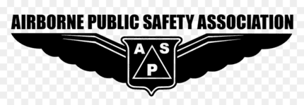
- Airborne Public Safety Association Basic Proficiency & Emergency Response Pilot (BPERP)
- Level 1 sUAS Thermography Certification


Our Mission Process
Our work follows a simple four‑step process
This repeatable approach means you know exactly what to expect from us every time.
01
Listen
You define the decision. Tell us what you need to confirm, document, prove, measure, compare, or search. Every mission starts with a decision—not a flight.
02
Plan
We validate the site or incident location, timing, access needs, airspace, and what we can realistically and safely capture.
03
Fly
Structured routes. Repeatable angles. discipline. Adjustments if conditions change. We don’t freelance in the sky, we execute.
04
Deliver
Maps, imagery, summaries, and comparison sets—organized and ready for your project management, claims, maintenance, or review workflow.
Where We Operate
Blue Nose primarily serves Boise, Nampa, Meridian, Caldwell, and the entire Treasure Valley, with the ability to travel regionally across Idaho and neighboring states when projects or incidents require it.
We operate under FAA Part 107, meet all baseline safety and regulatory requirements, and coordinate with local agencies whenever missions intersect with sensitive areas or public operations.
What We Stand For
We exist to replace assumptions with aerial truth — accurate, defensible, no shortcuts.
Blue Nose was built by a veteran, for a community. We serve the people keeping this valley running, and we create career pathways for veterans who carry the discipline this work demands.
[ Integrity in Every File]
How We Protect Data Integrity
SkyArc doesn’t deliver images that “look” like evidence; we deliver digital records that are evidence.
Every file includes its original, unaltered metadata:
- EXIF timestamps
- GPS coordinates tied to camera position
- Altitude and aircraft attitude metrics
- Camera angle and gimbal orientation
- UTC capture time for auditing and claims
- Direct linkage to mission flight logs
This provides a verifiable chain of capture that supports claims, progress reviews, incident reports, maintenance planning, and any situation where someone may later ask, “When exactly was this taken, and from where?”
We never strip metadata, rename files in ways that break chronology, or alter source imagery.
What you receive is the true digital record tied to the mission log—clean, defensible, and traceable.

[elementor-template id=”1496″]